


Hiking in East Yellowstone, Yellowstone National Park, & Shoshone National Forest
Shoshone National Forest Hikes
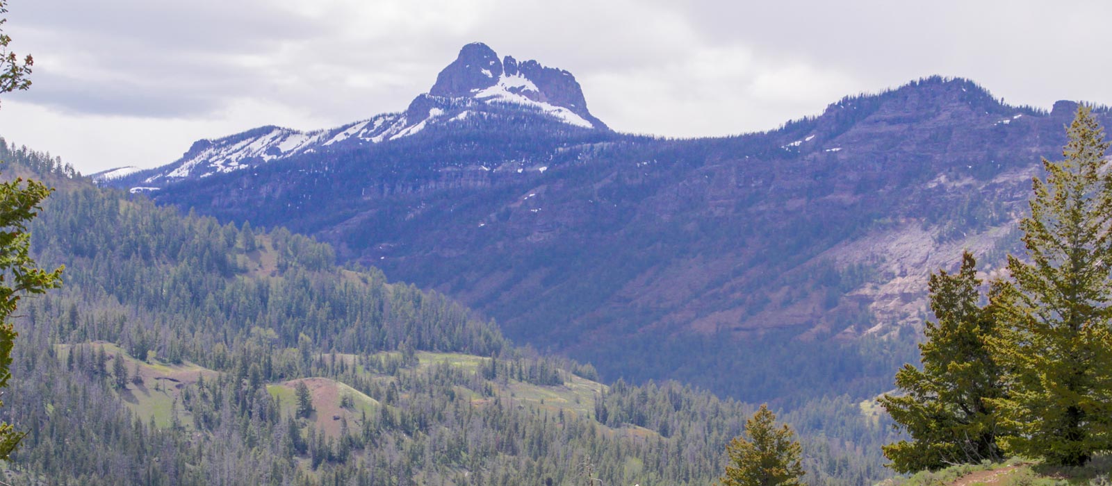
About 940 miles of trail wind through the Shoshone’s 2.5 million acres. Hikers pass through terrain ranging from sagebrush flats to rugged mountain peaks. Trails vary in length, difficulty, and elevation change.
Wildlife on the Shoshone includes deer, elk, moose, bighorn sheep, mountain goats, grizzlies, and black bears, as well as numerous smaller animals, birds, and cold-water fish. Please check trailhead bulletin boards for possible closures, special bear orders, and other current information.
East Yellowstone and Shoshone National Forest Hikes
Pahaska-Sunlight Hike:
Length (miles): 18
Level of Use: Heavy
Difficulty: Moderate
Elevation Change: 6,500-10,200
Trailhead, Access, and Other Information: Camp Monaco – Waterfalls
Eagle Creek Hike
Length (miles): 14.7
Level of Use: Heavy
Difficulty: Moderate
Elevation Change: 6,700-9,900
Trailhead, Access, and Other Information: Meadows-Eagle Pass-Yellowstone National Park
Elk Fork Hike
Length (miles): 21
Level of Use: Heavy
Difficulty: Moderate
Elevation Change: 6,000-11,800
Trailhead, Access, and Other Information: Rampart Pass-Meadows-Teton National Forest
Blackwater (Fire Memorial) (National Recreation Trail) Hike
Length (miles): 5
Level of Use: Light-Mod
Difficulty: Moderate
Elevation Change: 6,000-10,000
Trailhead, Access, and Other Information: Fire Memorial origin-Clayton Mountain
Kitty Creek
Length (miles): 6.5
Level of Use: Heavy
Difficulty: Moderate
Elevation Change: 7,000-10,000
Trailhead, Access, and Other Information: Paradise Valley-Flora Lake
Green Creek Hike
Length (miles): 6
Level of Use: Light
Difficulty: Moderate
Elevation Change: 6,700-8,700
Trailhead, Access, and Other Information: Ptarmigan Mountain-Table Mountain Trail
Grinnell Creek Hike
Length (miles): 6
Level of Use: Light
Difficulty: Moderate
Elevation Change: 6,600-7,700
Trailhead, Access, and Other Information: Grinnell Meadows, beware of moose
Clearwater Creek Hike
Length (miles): 4
Level of Use: Light
Difficulty: Moderate
Elevation Change: 6,000-7,200
Trailhead, Access, and Other Information: Volcanic Outcrops-maintained 4 miles
Fishhawk Hike
Length (miles): 14
Level of Use: Heavy-Mod
Difficulty: Moderate
Elevation Change: 6,800-10,000
Trailhead, Access, and Other Information: Fishhawk Meadows-Teton National Forest
Mormon Creek
Length (miles): 5.3
Level of Use: Light
Difficulty: Moderate Elevation Change: 6,200-10,000
Trailhead, Access, and Other Information: View Sleeping Giant Mountain
Crow Creek Hike
Length (miles): 11
Level of Use: Moderate
Difficulty: Moderate
Elevation Change: 6,600-10,500
Trailhead, Access, and Other Information: Go up Pahaska-Sunlight Trail 1 mile to Crow Creek Jct. Cody Peak, Yellowstone N.P.
Red Creek Hike
Length (miles): 6.5
Level of Use: Light
Difficulty: Moderate
Elevation Change: 7,500-9,500
Trailhead, Access, and Other Information: Go up Pahaska-Sunlight Trail 6 miles to Red Creek Junction, Frost Lake, Grant Peak, Notch Mountain.
Yellowstone Hikes:
Day Hikes near Old Faithful. Trail conditions may change suddenly and unexpectedly. Bear activity, rain or snow storms, high water, and fires may temporarily close trails.
Geyser Hill Loop Trail Hike
This short loop trail gives visitors a good chance of seeing a variety of geysers, from the ever-entertaining Anemone with its short intervals of 5-10 minutes to the impressive Beehive with its unpredictable eruptions reaching 100-150 feet!
Trailhead: Boardwalk in front of Old Faithful Visitor Center
Distance: 1.3 mile (1.2 km) loop
Level of Difficulty: Easy
Numerous other combination loops or one-way walks can be chosen in the Upper Geyser Basin. Features such as Castle, Grand, Riverside, and Daisy geysers along with Morning Glory Pool are easily accessed using the Old Faithful self-guiding trail map. Details on geyser prediction times may be obtained by stopping by the visitor center.
Observation Point Loop Trail Hike
This trail gains about 200 ft. in elevation to a prominent overlook providing a great view of the Upper Geyser Basin.
Trailhead: Firehole River footbridge behind Old Faithful Geyser
Distance: 1.1 miles (1 km) loop
Level of Difficulty: Moderate
Mallard Lake Trail Hike
This trail climbs through a lodgepole pine forest (some burned areas from the 1988 fires) and along meadows and rocky slopes before terminating at Mallard Lake.
Trailhead: Old Faithful Lodge cabin area
Distance: 6.8 miles (5.3 km) roundtrip
Level of Difficulty: Moderate
Lone Star Geyser Trail Hike
This mostly level trail follows an old service road along the Firehole River through unburned forests of lodgepole pine. The geyser, which erupts approximately every 3 hours, puts on a delightful show. This trail can be accessed by bicycle with the final approach to the geyser on foot.
Trailhead: 3.5 miles southeast of the Old Faithful area, just beyond Kepler Cascades parking area.
Distance: 5 miles (8 km) roundtrip
Level of Difficulty: Easy
Black Sand Hike and Biscuit Basin Hike Trails
Easily accessed by boardwalks less than a mile in length, Emerald Pool, Sunset Lake, Jewel Geyser, and Sapphire Pool are among the features found in these less-visited basins. Both areas are included in the Old Faithful area trail guide.
Trailhead: 0.5 and 2 miles north of Old Faithful area, respectively
Distance: Less than 0.5 (0.5 km) miles each
Level of Difficulty: Easy
Midway Geyser Basin Trail Hike
The boardwalk leads visitors by impressive features including Excelsior Geyser and Grand Prismatic Spring.
Trailhead: Parking area 6 miles north of Old Faithful
Distance: 0.5 mile (0.5 km) loop
Level of Difficulty: Easy
Fountain Paint Pot Trail Hike
Yellowstone’s four types of thermal features can be seen in one short walk along this loop trail: geysers, hot springs, mud pots, and fumaroles. A trail guide is available for this area, which also includes the Firehole Lake Drive area.
Trailhead: Parking area 8 miles north of Old Faithful
Distance: 0.5 mile (0.8 km) loop
Level of Difficulty: Easy
Mystic Falls Trail Hike
This trail follows a lovely creek through a lodgepole pine forest before reaching the 70-foot falls. By following a series of switchbacks, an overlook of the Upper Geyser Basin can be reached before looping back to join the main trail.
Trailhead: Back of the Biscuit Basin boardwalk
Distance: 2.4 miles (4 km) roundtrip
Level of Difficulty: Moderate
Fairy Falls Trail Hike
At 200 feet high, Fairy Falls is an impressive backcountry sight. It can be reached from two different trailheads. The first trailhead, 1 mile south of the Midway Geyser Basin, begins at a steel bridge across the Firehole River and follows the Fountain Freight Road hiking/biking trail for approximately 1 mile before the hiking-only trail to Fairy Falls branches off on the left. The second trailhead, a half-mile south of the Nez Perce picnic area on the Fountain Freight Road, follows the hiking/biking path from the northern end, 1.75 miles to the junction with the Fairy Falls trail.
Trailhead: 1) Steel Bridge parking area 1 mile south of the Midway Geyser Basin
2) Fountain Freight Road parking area 1 mile south of Nez Perce picnic area on the Fountain Freight Road
Distance: 5 miles (8 km) from trailhead #1; 7 miles (5.5 km) from Trailhead #2
Level of Difficulty: Easy